A bigger thunderstorm clouds is just emerging over Southern Sweden, between Växjö and Jönköping. It isn't so often you see those more massive, round large blobs over Sweden... If at all, then only occationally during peak summer.
SMHI's radar isn't working right now. No updates on their homepage.
So, there is that.
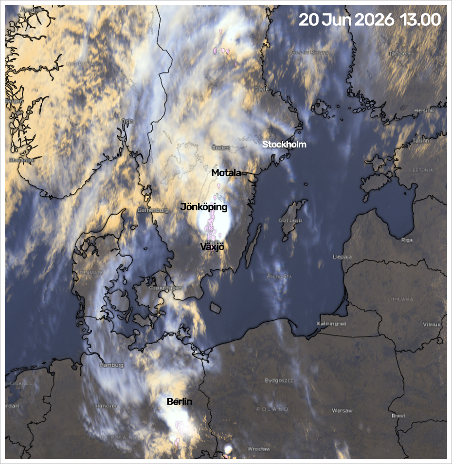
The whole airmass on the satellite chart
is moving towards Northeast, while the coldfront, diffusely visible over South Norway, pushes from west to east. The clouds should soon get more dense, and perhaps we get some rain and thunderstorms around 17-18.00 i would guess.
Unless the "Ludo Effect" spills the fun by kicking out storm cells prior entering our sky. Or just dissolve right before moving over the city.
It wouldn't surprise me...
The wind whispers a story
If i wouldn't have any internet or anything else as a reference - my ears wold have picked up two things; the cirrus clouds getting denser / more numerous. Then there is the wind's own tale being spoken.
It isn't gusty like in autumn - but there is an unsettled sense in the air as the wind flows through the trees. It sounds like gusts, but isn't nearly as hard. The current weather isn't acting like a calm, hot summer day where nothing is moving, and the weather stable. The air sounds too unsettled for that. Like a whisper of changes coming this way.
Working again (partially)
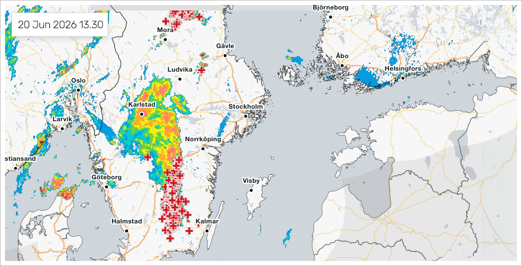
the SMHI radar is working again. Somewhat. Something is going on - but the lightning is concentrated to the South of Sweden. Now is the time in which several thunderstorm blobs are growing, like mushrooms, over places like Southern Sweden.
Yet also over Sundsvall in Southern Norrland at the Bothnian Bay, Then a larger cluster south of Berlin, and a minor near Wroclaw in Poland. Lots of activity also over east Austria / Alps / Vienna, where it looks like popcorn starting up.
Neat.
|